Somerset floods, 2013–14
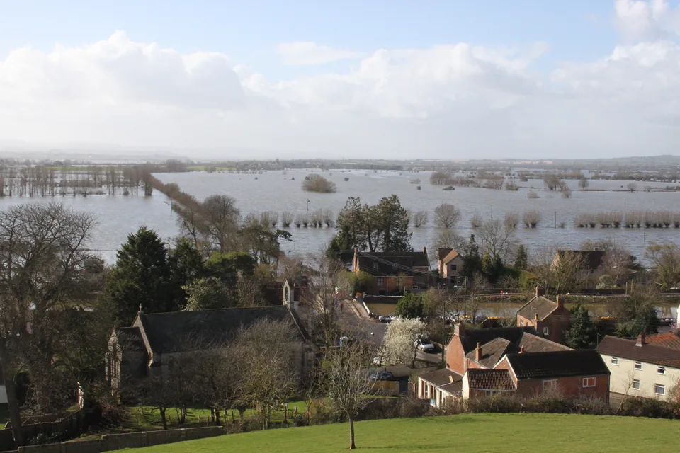

Setting
The Somerset Levels and Moors are flat, low-lying land managed through drainage. The Parrett and Tone catchments suffered extensive flooding in early 2014.
Sources: gov.uk
Persistent rainfall
Successive Atlantic storms brought repeated rain through winter 2013–14. The Met Office links their persistence to atmospheric conditions that kept the jet stream in an unusual position.
Sources: metoffice.gov.uk
Flood impacts
The Environment Agency estimates that 100 million cubic metres of water covered 65 square kilometres on the Levels and Moors. It records 172 flooded properties. Communities were cut off, and Northmoor residents left their homes.
Sources: gov.uk
Response and rebuilding
Authorities increased pumping during the emergency. The March 2014 plan proposed dredging 8 km of the Parrett and Tone and improving roads; the government's publication record later confirmed completion of the dredging.
Managing a drainage landscape
Later work included raising the road between Muchelney and Drayton, maintaining dredged channels and improving pumping. These measures address access and drainage together. Dredging alone does not remove the need to manage water across the catchment.
Sources: gov.uk
Using this case in an answer
Connect persistent rainfall with a low, drained landscape and disrupted access. Compare emergency pumping with later dredging and catchment management, keeping plans and completed work separate.
- The March dredging commitment and November completion are separate stages.
- Flooded area, water volume and flooded properties are different measurements.
Saved on this browser. An example’s listed role does not certify that it covers every specification dimension.
Evidence and its scope
| Claim | Period and scope | Source |
|---|---|---|
| Estimated floodwater volume 100 million cubic metres | Early 2014 event; retrospective updated September 2026 | Open source |
| Estimated flooded area 65 square kilometres | Early 2014 | Open source |
| 172 properties flooded | Early 2014 | Open source |
| Winter rainfall broke records for the UK and southern England | December 2013–February 2014; Met Office analysis published June 2017 | Open source |
| Dredging 8 km of Parrett and Tone proposed | 6 March 2014 action-plan announcement | Open source |
| Publication update records 8 km dredging complete | 13 November 2014 publication update | Open source |
Possible requirement roles
- River flooding and managementSeparate the catchment, affected settlement and intervention.; Explain rainfall, flows, exposure and response.; Assess residual risk and avoid promising complete protection.
Recall the evidence
Case-recall questions load here. The sourced evidence remains available below.
Practise using the evidence
Apply a related skill
Climate graphs · Contours and relief · Source evaluation
Related lessons
Rivers and flooding · Weather hazards and atmospheric circulation
Build a better answer
Use a fresh resource to practise selecting evidence and explaining its significance.