Japan earthquake and tsunami, 2011
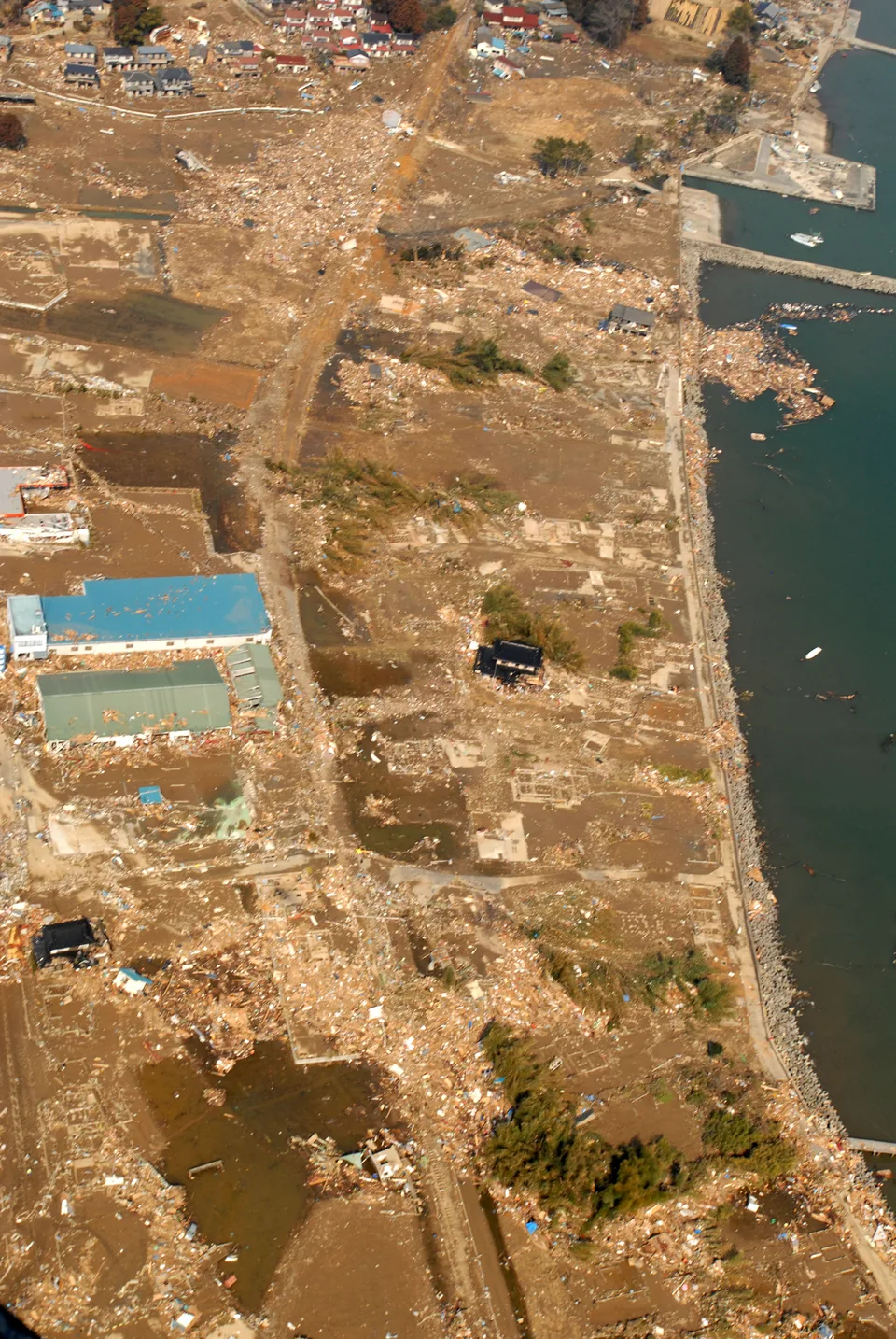

Setting
The earthquake struck offshore from north-eastern Honshu at 14:46 Japan time on 11 March 2011. Japan's Reconstruction Agency gives magnitude 9.0. USGS reports a preferred revised magnitude of 9.1; give the source when using either value.
Sources: reconstruction.go.jp 1 · earthquake.usgs.gov 2
A linked disaster
The earthquake generated a tsunami that damaged the Pacific coast. The tsunami also triggered the Fukushima Daiichi nuclear accident, extending displacement beyond places directly flooded.
Sources: data.jma.go.jp 1 · reconstruction.go.jp 2
Damage and displacement
About 122,000 buildings were completely destroyed, and over 470,000 people evacuated. The agency estimated direct damage at 16.9 trillion yen in June 2011.
Sources: reconstruction.go.jp
Warnings and their limits
JMA issued the first tsunami warning about three minutes after the earthquake. Its initial magnitude estimate was too low, which also reduced forecast tsunami heights. Early reports of small waves could encourage people to delay evacuation.
Sources: data.jma.go.jp
Changes after the disaster
JMA introduced a revised warning system on 7 March 2013. By May 2023, roughly 30,000 people remained evacuated. Rebuilding infrastructure and enabling people to return took different lengths of time.
Sources: data.jma.go.jp 1 · reconstruction.go.jp 2
Using this case in an answer
Explain the offshore earthquake, the tsunami and the resulting nuclear emergency. Evaluate preparation through warning speed, forecast accuracy and evacuation, then compare physical reconstruction with continuing displacement.
- Japanese authorities report Mw 9.0; USGS reports Mw 9.1. These are different published magnitude conventions for the same event.
- Remaining evacuees are a May 2023 snapshot. Direct damage in yen differs from wider economic cost estimates.
Saved on this browser. An example’s listed role does not certify that it covers every specification dimension.
Evidence and its scope
| Claim | Period and scope | Source |
|---|---|---|
| The preferred revised USGS event magnitude is 9.1. Japanese authorities report 9.0 for the same event. | 11 March 2011; revised USGS event record | Open source |
| Magnitude reported by Japanese authorities 9.0 Mw | 11 March 2011 | Open source |
| Approximately 122,000 buildings completely destroyed | 2011 disaster; agency retrospective | Open source |
| Over 470,000 people evacuated | 2011 disaster | Open source |
| Direct damage estimate of 16.9 trillion yen | Estimate as of June 2011 | Open source |
| First tsunami warning issued about three minutes after the earthquake 3 minutes (approximately) | 11 March 2011 | Open source |
| Revised tsunami warning system introduced | 7 March 2013 | Open source |
| Approximately 30,000 people remained evacuated | May 2023 | Open source |
Possible requirement roles
- A tectonic hazard eventName and date the event.; Separate the tectonic process from exposure and vulnerability.; Use contrasting examples where your specification requires them.
Recall the evidence
Case-recall questions load here. The sourced evidence remains available below.
Practise using the evidence
Apply a related skill
Source evaluation · Map scale and distance
Compare with Haiti earthquake, 2010
Compare the hazard processes, building exposure and vulnerability. Use separate observations for shaking and tsunami impacts.
Check the comparison
Use a shared criterion, explain the geographical process and keep each source’s period and boundary. Different totals may reflect different definitions or populations. A comparison needs more than two separate descriptions.
Related lessons
Tectonic hazards: explain the different impacts · Hazard systems: cascades, probability and resilience
Build a better answer
Use a fresh resource to practise selecting evidence and explaining its significance.