Typhoon Haiyan, 2013
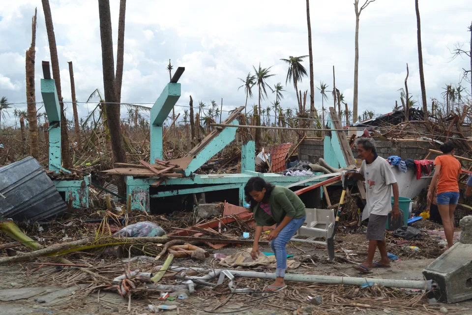

Setting
Haiyan, called Yolanda in the Philippines, struck the country on 8 November 2013. Tacloban stands beside Leyte Gulf, where the storm drove water towards the coast.
Sources: documents1.worldbank.org 1 · gpm.nasa.gov 2
Storm surge
NASA described winds funnelling water into the north-western corner of Leyte Gulf. Its November 2013 account reported a surge up to 5.2 metres at Tacloban. This local water-level report is separate from wind speed.
Sources: gpm.nasa.gov
People and services
WHO's retrospective reports 6,300 deaths, about 28,000 injuries and damage or destruction at more than 2,000 health facilities. Disrupted services made emergency care harder to provide.
Sources: who.int
Cash support
The government temporarily removed conditions from existing 4Ps cash grants. WFP and UNICEF added payments through that system, using an established route to reach affected families.
Sources: documents1.worldbank.org
Who could be missed?
An existing benefit register helped deliver support, but poor households outside 4Ps could not receive grants through that route. The World Bank proposed a separate emergency programme with wider reach; this proposal is not evidence that every household later received support.
Sources: documents1.worldbank.org
Using this case in an answer
Explain how strong winds, storm surge and heavy rain affect exposed coastal communities. Separate immediate losses and displacement from relief and longer-term recovery, using the date and area of each observation.
- Storm-surge height is a local reported maximum; impact counts cover the areas and dates stated by each source.
Saved on this browser. An example’s listed role does not certify that it covers every specification dimension.
Evidence and its scope
| Claim | Period and scope | Source |
|---|---|---|
| Philippines landfall date | 8 November 2013 | Open source |
| Surge reported up to 5.2 metres at Tacloban | NASA account in November 2013 | Open source |
| 6,300 people killed | 2013 event; WHO retrospective published 2018 | Open source |
| More than 2,000 health facilities damaged or destroyed | 2013 storm; WHO retrospective | Open source |
| 4.1 million people displaced | 2013 disaster; World Bank retrospective | Open source |
| Conditions on existing 4Ps payments were temporarily waived | Post-Haiyan response | Open source |
Possible requirement roles
- A tropical stormName and date the storm.; Explain hazards, impacts and responses.; Identify whether a number is an estimate, observation or forecast.
Recall the evidence
Case-recall questions load here. The sourced evidence remains available below.
Practise using the evidence
Apply a related skill
Source evaluation · Contours and relief
Compare with Hurricane Katrina, 2005
Compare exposure, warning, evacuation and recovery. Keep damage estimates tied to their source definitions.
Check the comparison
Use a shared criterion, explain the geographical process and keep each source’s period and boundary. Different totals may reflect different definitions or populations. A comparison needs more than two separate descriptions.
Related lessons
Weather hazards and atmospheric circulation
Use this case in a different answer
Worked question: Recall the local name of Typhoon Haiyan.
Yolanda.
Keep the evidence precise: Philippines landfall date This refers to Haiyan/Yolanda Philippines event, 8 November 2013. Check the source
Try it yourself
Explain why a storm-surge estimate from one coastal location should not be applied to every settlement affected by Haiyan.
One possible answer
Storm winds can push water towards the coast, but coastal shape, elevation and tide affect local levels and how far water travels inland. A site estimate describes that setting. Other settlements need their own evidence about water levels and exposure.
Check your answer: did you address the question, use accurate evidence and explain the link?
Build a better answer
Use a fresh resource to practise selecting evidence and explaining its significance.