Hurricane Katrina, 2005

Setting
Katrina crossed the northern Gulf coast on 29 August 2005. New Orleans depended on levees, floodwalls and pumps to manage flood risk.
Sources: mvn.usace.army.mil
Why flood defences failed
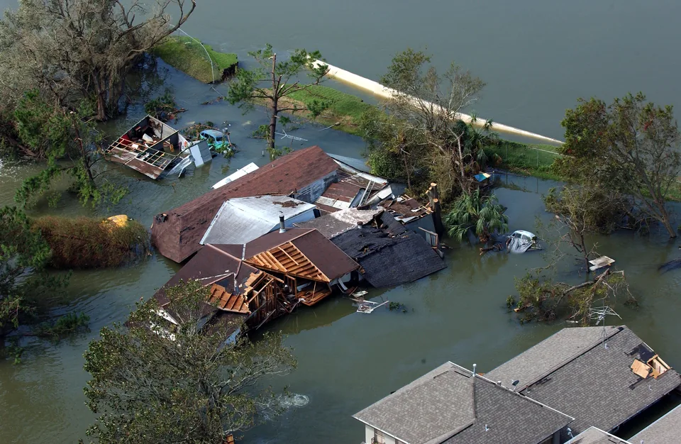
Storm surge strained the protection system. Some floodwalls failed before water reached their tops; other structures were overtopped. Floodwater eventually covered about 80% of New Orleans.
Sources: upload.wikimedia.org
Human and economic costs
The NHC's 2023 revision gives 1,392 fatalities across direct, indirect and indeterminate causes. Its US damage estimate is $125 billion in 2005 dollars. These figures cover Katrina's US impacts, not New Orleans alone.
Sources: upload.wikimedia.org
Emergency response
The Coast Guard and other responders rescued survivors from rooftops. Engineers repaired flood defences and pumped water out while planning a stronger regional system.
Sources: usace.army.mil
Reducing future risk
The replacement system combines levees, floodwalls, gates and pumps. FEMA accredited it in February 2014 for a 1% annual chance level of flood risk reduction. Evacuation planning remains necessary because greater events and failures remain possible.
Sources: usace.army.mil 1 · mvd.usace.army.mil 2
Using this case in an answer
Connect the storm with coastal exposure and flood-protection failures. Evaluate emergency response and later engineering separately, including the continuing need for evacuation.
- Use the revised NHC fatality total with its report date. Older sources give different totals.
- A 1% annual-chance standard reduces risk; it does not prevent every flood or replace evacuation.
Saved on this browser. An example’s listed role does not certify that it covers every specification dimension.
Evidence and its scope
| Claim | Period and scope | Source |
|---|---|---|
| Katrina weakened from Category 5 to Category 3 before Louisiana landfall | 28–29 August 2005 | Open source |
| Approximately 80% of New Orleans flooded | Within about a day of landfall, August 2005 | Open source |
| Revised fatality total: 520 direct, 565 indirect and 307 indeterminate 1,392 fatalities | NHC revision January 2023, concerning 2005 event | Open source |
| Damage estimate 125 billion USD (2005 prices) | 2005 event; NHC updated report | Open source |
| FEMA accreditation announced for the replacement protection system | 21 February 2014 announcement; accreditation previous day | Open source |
| Design addresses a surge level with 1% chance in any year | Post-Katrina system described in 2025 retrospective | Open source |
Possible requirement roles
- A tropical stormName and date the storm.; Explain hazards, impacts and responses.; Identify whether a number is an estimate, observation or forecast.
Recall the evidence
Case-recall questions load here. The sourced evidence remains available below.
Practise using the evidence
Apply a related skill
Source evaluation · Choropleth maps
Related lessons
Weather hazards and atmospheric circulation
Build a better answer
Use a fresh resource to practise selecting evidence and explaining its significance.